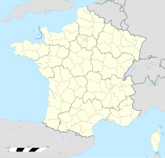
Ploërmel
Erscheinungsbild
| Ploërmel | |
 | |
| Verwàltung | |
|---|---|
| Land | |
| Region | |
| Département | Morbihan (56) |
| Arrondissement | Vannes |
| Kànton | Ploërmel |
| Kommünàlverbànd | Ploërmel Communauté |
| Àmtliga Nàma | Ploërmel |
| Maire | Patrick Le Diffon (2014-2020)[1] |
| Code Insee | 56165 |
| Poschtlaitzàhl | 56800 |
| Iiwohner | |
| Iiwohner | 9.879 |
| Flech | 57,82 km2 |
| Bevelkerungsdicht | 155,79 Iiw./km2 |
| Làg | |
| Koordinate | 47° 55′ 54″ N, 2° 23′ 51″ W / 47.931666666667°N,2.3975°WKoordinate: 47° 55′ 54″ N, 2° 23′ 51″ W / 47.931666666667°N,2.3975°W |
| Heche | 76 m |
| Website | |
| https://www.ploermel.bzh/ | |
Ploërmel (bretonisch Ploermael, Gallo Ploermaèu) isch e franzesischi Gmai im Département Morbihan in dr Region Bretagne.
D Gmai ghert zum Kanton Ploërmel un zum Arrondissement Vannes.
Geografi
[ändere | Quälltäxt bearbeite]Ploërmel lyt 41 km vu Vannes un 75 km vu Lorient uf ere Hechi zwische 19 m un 106 m iber Normalnull.
Gschicht
[ändere | Quälltäxt bearbeite]Ploërmel isch zum erschte Mol gnännt wore anne 835 as Plebs Arthmael (1082: Ploiarmel, 1090: Arsmel de Ploasmela, 1118: Ploasmel, 1124: Ploermel).
Verwaltig
[ändere | Quälltäxt bearbeite]Dr Maire vu Ploërmel isch dr Patrick Le Diffon. Ploërmel ghert zum Kommunalverband Ploërmel Communauté.
Bevelkerigsentwicklig
[ändere | Quälltäxt bearbeite]| Johr | 1962 | 1968 | 1975 | 1982 | 1990 | 1999 | 2008 |
| Yywohner | 5.723 | 5.907 | 6.218 | 6.563 | 6.996 | 7.525 | 8.790 |
Dialekt
[ändere | Quälltäxt bearbeite]Dr traditionell Dialäkt vu Ploërmel ghert zum Bretonisch.
Böuwärch
[ändere | Quälltäxt bearbeite]- Chilche Saint-Armel (15. Jh.)
- Chilche Saint-Golven (15./16. Jh.)
- Kapäll Saint-Roch (14. Jh.)
- Kapäll Saint-Jean-Baptiste, Tréhorenteuc (14. Jh.)
- Kapäll Saint-Antoine (15. Jh.)
- Kapäll Saint-Joseph, Roc-Briend (16./17. Jh.)
- Kapäll Saint-Marc du Château de Malleville (1520)
- Kapäll des Carmes (17. Jh.)
- Kapäll Saint-Denis (18. Jh.)
- Kapäll Saint-Nicodème
- Karmelite-Chloschter (18. Jh.)
- Ursuline-Chloschter (17./18. Jh.)
- Château de Saint-Malo (1900)
- Château de Boyac ou Boyeac (15./17. Jh.)
- Château de Malleville (1520)
- Château de Ker-Armel (1906-08)
- Les rochers de la Valette (Neolithikum)
-
Chilche Saint-Armel -
Bahnhof
Weblink
[ändere | Quälltäxt bearbeite]- http://www.ploermel.com
- Ploërmel uf geobreizh.com (Internet-Archive)
Fueßnote
[ändere | Quälltäxt bearbeite]- ↑ Liste des maires au 25 avril 2014 (data.gouv.fr)


