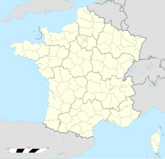
Moréac
Erscheinungsbild
| Moréac | |
 | |
| Verwàltung | |
|---|---|
| Land | |
| Region | |
| Département | Morbihan (56) |
| Arrondissement | Pontivy |
| Kànton | Moréac |
| Kommünàlverbànd | Centre Morbihan Communauté |
| Àmtliga Nàma | Moréac |
| Maire | Pascal Roselier (2014-2020)[1] |
| Code Insee | 56140 |
| Poschtlaitzàhl | 56500 |
| Iiwohner | |
| Iiwohner | 3.698 |
| Flech | 60,3 km2 |
| Bevelkerungsdicht | 60,91 Iiw./km2 |
| Làg | |
| Koordinate | 47° 55′ 09″ N, 2° 49′ 16″ W / 47.919166666667°N,2.8211111111111°WKoordinate: 47° 55′ 09″ N, 2° 49′ 16″ W / 47.919166666667°N,2.8211111111111°W |
| Heche | 123 m |
| Website | |
| http://www.moreac.fr | |
Moréac (bretonisch Mourieg, Gallo Moreiac) isch e franzesischi Gmai im Département Morbihan in dr Region Bretagne.
D Gmai ghert zum Kanton Moréac un zum Arrondissement Pontivy.
Geografi
[ändere | Quälltäxt bearbeite]Moréac lyt 30 km vu Vannes un 45 km vu Lorient uf ere Hechi zwische 57 m un 149 m iber Normalnull.
Gschicht
[ändere | Quälltäxt bearbeite]Moréac isch zum erschte Mol gnännt wore anne 1008 as Moriacum (1273: Moreyac, 1280: Moreiac, 1387: Moreac).
Verwaltig
[ändere | Quälltäxt bearbeite]Dr Maire vu Moréac isch dr Pascal Roselier. Moréac ghert zum Kommunalverband Centre Morbihan Communauté.
Bevelkerigsentwicklig
[ändere | Quälltäxt bearbeite]| Johr | 1962 | 1968 | 1975 | 1982 | 1990 | 1999 | 2008 |
| Yywohner | 2.733 | 2.593 | 2.662 | 2.766 | 2.920 | 2.893 | 3.564 |
Dialekt
[ändere | Quälltäxt bearbeite]Dr traditionell Dialäkt vu Moréac ghert zum Bretonisch.
Böuwärch
[ändere | Quälltäxt bearbeite]- Chilche Saint-Cyr (18. Jh.)
- Kapäll Saint-Esprit, Faouët-d'En-Haut (1644)
- Kapäll Saint-Jean-Baptiste, Lojean (1627)
- Kapäll Saint-Ivy (1887-88)
Weblink
[ändere | Quälltäxt bearbeite]- http://www.moreac.fr
- Moréac uf geobreizh.com (Internet-Archive)
Fueßnote
[ändere | Quälltäxt bearbeite]- ↑ Liste des maires au 25 avril 2014 (data.gouv.fr)

