
Datei:Philippines relief location map (Palawan).svg

Gröössi vor PNG-Vorschou vor SVG-Datei: 377 × 377 Pixel. Wyteri Ufflösige: 240 × 240 Pixel | 480 × 480 Pixel | 768 × 768 Pixel | 1.024 × 1.024 Pixel | 2.048 × 2.048 Pixel.
Originaldatei (SVG-Datei, Basisgrößi: 377 × 377 Pixel, Dateigrößi: 2,21 MB)
| Die Datei un d Informatione derzue were us em zäntrale Mediearchiv Wikimedia Commons (Allmänd) iibunde. | Zur Bschriibigssite uff de Allmänd |
.svg?uselang=als)
Bschryybig
| Bschryybig |
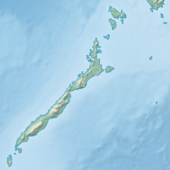
English: Physical location map of the Philippines (Palawan)
Equirectangular projection based on the parallel of 10°43' N
|
| Datum | |
| Quälle | File:Philippines location map (square).svg |
| Urheber | User:Hellerick |
| Anderi Versione |
Diese Datei wurde von diesem Werk abgeleitet: Philippines relief location map (square).svg: .svg) |
.svg)
Lizänzierig
Die Datei isch lizänziert unter dr Creative-Commons-Lizenz Namensnännig – Wytergab unter glyche Bedingige 3.0 nit portiert.
- Du derfsch:
- des Wärch an anderi wytergee – des Wärch kopiere, verbreite un ibertrage
- des Wärch verändere – des Wärch aapasse
- Unter däne Bedingige:
- Namenännig – Du muesch aagmässeni Aagabe zum Urheber un dr Rächt mache, e Link zue dr Lizänz zuefiege un aagee, eb Änderige gmacht wore sin. Die Aagabe chenne in ere aagmässene Art gmacht wäre, aber nit eso, ass dr Yydruck entstoht, ass dr Lizänzgeber Dii oder Dyy Gebruch vum Wärch unterstitze un guetheiße.
- Wytergab unter glyche Bedingige – Wänn du des Wärch veränderesch, umwandlesch oder druf ufböusch, no derfsch s Ergebnis nume unter dr glyche oder ere kumpatible Lizänz wie s Orginal vereffetlige.
Dateiversione
Klick uf e Zytpunkt zu aazeige, wie s dert usgsäh het.
| Version vom | Vorschaubild | Mäß | Benutzer | Kommentar | |
|---|---|---|---|---|---|
| aktuell | 19:23, 26. Okt. 2017 | | 377 × 377 (2,21 MB) | Mliu92 | User created page with UploadWizard |
Verwändig vu dr Datei
Kei Artikel bruucht die Datei.
Wältwyti Dateinutzig
Die andere Wikis bruche die Datei:
- Gebruch uf ban.wikipedia.org
- Gebruch uf bcl.wikipedia.org
- Gebruch uf en.wikipedia.org
- Busuanga Island
- Tubbataha Reef
- Calamian Islands
- Puerto Princesa Subterranean River National Park
- Mindoro Strait
- Balabac Island
- Mangarin Bay
- Mount Mantalingajan
- Honda Bay
- Calauit Island
- Rasa Island
- Malampaya Sound
- Delian Island
- Module:Location map/data/Palawan
- Module:Location map/data/Palawan/doc
- Bacungan River
- Gebruch uf fa.wikipedia.org
- Gebruch uf fr.wikipedia.org
- Gebruch uf id.wikipedia.org
- Gebruch uf ilo.wikipedia.org
- Gebruch uf lv.wikipedia.org
- Gebruch uf ml.wikipedia.org
- Gebruch uf si.wikipedia.org
- Gebruch uf uz.wikipedia.org
.svg)