
Datei:Philippines relief location map (Mindanao).svg

Gröössi vor PNG-Vorschou vor SVG-Datei: 656 × 486 Pixel. Wyteri Ufflösige: 320 × 237 Pixel | 640 × 474 Pixel | 1.024 × 759 Pixel | 1.280 × 948 Pixel | 2.560 × 1.897 Pixel.
Originaldatei (SVG-Datei, Basisgrößi: 656 × 486 Pixel, Dateigrößi: 2,21 MB)
| Die Datei un d Informatione derzue were us em zäntrale Mediearchiv Wikimedia Commons (Allmänd) iibunde. | Zur Bschriibigssite uff de Allmänd |
.svg?uselang=als)
Bschryybig
| Bschryybig |
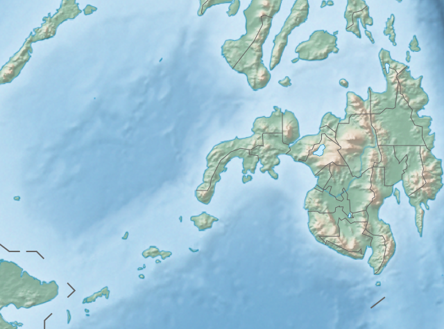
English: Physical location map of the Philippines (Mindanao)
Equirectangular projection based on the parallel of 10°43' N
|
| Datum | |
| Quälle | File:Philippines location map (square).svg |
| Urheber | User:Hellerick |
| Anderi Versione |
Diese Datei wurde von diesem Werk abgeleitet: Philippines relief location map (square).svg: .svg) |
.svg)
Lizänzierig
Die Datei isch lizänziert unter dr Creative-Commons-Lizenz Namensnännig – Wytergab unter glyche Bedingige 3.0 nit portiert.
- Du derfsch:
- des Wärch an anderi wytergee – des Wärch kopiere, verbreite un ibertrage
- des Wärch verändere – des Wärch aapasse
- Unter däne Bedingige:
- Namenännig – Du muesch aagmässeni Aagabe zum Urheber un dr Rächt mache, e Link zue dr Lizänz zuefiege un aagee, eb Änderige gmacht wore sin. Die Aagabe chenne in ere aagmässene Art gmacht wäre, aber nit eso, ass dr Yydruck entstoht, ass dr Lizänzgeber Dii oder Dyy Gebruch vum Wärch unterstitze un guetheiße.
- Wytergab unter glyche Bedingige – Wänn du des Wärch veränderesch, umwandlesch oder druf ufböusch, no derfsch s Ergebnis nume unter dr glyche oder ere kumpatible Lizänz wie s Orginal vereffetlige.
Dateiversione
Klick uf e Zytpunkt zu aazeige, wie s dert usgsäh het.
| Version vom | Vorschaubild | Mäß | Benutzer | Kommentar | |
|---|---|---|---|---|---|
| aktuell | 16:36, 27. Okt. 2017 | | 656 × 486 (2,21 MB) | Mliu92 | Updated crop to add missing island. |
| 19:23, 26. Okt. 2017 |  | 573 × 573 (2,21 MB) | Mliu92 | User created page with UploadWizard |
Verwändig vu dr Datei
Kei Artikel bruucht die Datei.
Wältwyti Dateinutzig
Die andere Wikis bruche die Datei:
- Gebruch uf bcl.wikipedia.org
- Gebruch uf bn.wikipedia.org
- Gebruch uf en.wikipedia.org
- Sulu Sea
- Moro Gulf
- Mount Apo
- Davao Gulf
- Iligan Bay
- Panguil Bay
- Bud Dajo
- Mount Butung
- Agusan River
- Lake Lanao
- Rio Grande de Mindanao
- Butuan Bay
- Mount Agad-Agad
- Mount Hibok-Hibok
- Mount Makaturing
- Mount Matutum
- Musuan Peak
- Agus River
- Sibuguey Bay
- Illana Bay
- Mount Sumagaya
- Dinagat Island
- Davao River
- Leonard Kniaseff
- Mount Kitanglad
- Macajalar Bay
- Pulangi River
- Cagayan River (Mindanao)
- Mount Dulang-dulang
- Tagoloan River
- Lake Buluan
- Lake Wood (Philippines)
- Lake Dapao
- Mount Malindang
- Mount Kalatungan
- Latukan
- Mount Balatukan
- Mount Hamiguitan
- Mount Baya
- Agusan Marsh Wildlife Sanctuary
- Camp General Basilio Navarro
- 2010 Mindanao earthquakes
- Manupali River
Wältwyti Verwändig vu däre Datei aaluege.
.svg)
.svg)