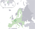
Datei:Location Luxembourg EU Europe.png
Erscheinungsbild

Greßi vu däre Vorschau: 721 × 600 Pixel. Wyteri Ufflösige: 289 × 240 Pixel | 577 × 480 Pixel | 923 × 768 Pixel | 1.231 × 1.024 Pixel | 2.056 × 1.710 Pixel.
Originaldatei (2.056 × 1.710 Pixel, Dateigrößi: 145 KB, MIME-Typ: image/png)
Dateiversione
Klick uf e Zytpunkt zu aazeige, wie s dert usgsäh het.
| Version vom | Vorschaubild | Mäß | Benutzer | Kommentar | |
|---|---|---|---|---|---|
| aktuell | 00:50, 12. Jul. 2020 |  | 2.056 × 1.710 (145 KB) | De728631 | added South Sudan to World map |
| 22:58, 11. Jul. 2020 |  | 2.056 × 1.710 (145 KB) | De728631 | Brexit update | |
| 02:11, 18. Jun. 2007 |  | 2.056 × 1.710 (177 KB) | Quizimodo~commonswiki | image (updated) | |
| 10:46, 17. Jun. 2007 |  | 2.056 × 1.710 (228 KB) | Quizimodo~commonswiki | image (tweaked) | |
| 09:28, 17. Jun. 2007 |  | 2.056 × 1.710 (229 KB) | Quizimodo~commonswiki | {{Information |Description=Location map: Luxembourg (dark green) / European Union (light green) / Europe (dark grey); inspired by and consistent with general country locator maps by User:Vardion, et al |Source=self-made |Date=17 June 2007 |Author= [[User: |
Verwändig vu dr Datei
Kei Artikel bruucht die Datei.


