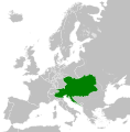
Datei:Austrian Empire (1815).svg

Originaldatei (SVG-Datei, Basisgrößi: 450 × 456 Pixel, Dateigrößi: 691 KB)
| Die Datei un d Informatione derzue were us em zäntrale Mediearchiv Wikimedia Commons (Allmänd) iibunde. | Zur Bschriibigssite uff de Allmänd |
Bschryybig
Kurzbeschreibungen
In dieser Datei abgebildete Objekte
Motiv
Einige Werte ohne einen Wikidata-Eintrag
Urheberrechtsstatus Tüütsch
urheberrechtlich geschützt Tüütsch
Lizenz Tüütsch
12. Ougschte 2013
Quelle der Datei Tüütsch
MIME-Typ Tüütsch
image/svg+xml
Prüfsumme Tüütsch
359d18403974b90c1403e1d91536ad4ac35c4fc2
Dateigröße Tüütsch
707.889 Byte
456 Pixel
Breite Tüütsch
450 Pixel
Dateiversione
Klick uf e Zytpunkt zu aazeige, wie s dert usgsäh het.
| Version vom | Vorschaubild | Mäß | Benutzer | Kommentar | |
|---|---|---|---|---|---|
| aktuell | 10:58, 16. Apr. 2019 |  | 450 × 456 (691 KB) | TRAJAN 117 | +++ |
| 22:20, 12. Aug. 2013 |  | 450 × 456 (654 KB) | TRAJAN 117 | Update | |
| 06:47, 12. Aug. 2013 |  | 450 × 456 (1 MB) | TRAJAN 117 | {{Information |Description ={{en|1=The Austrian Empire in 1815.}} |Source ={{own}} {{AttribSVG|Blank map of Europe 1815.svg|Alphathon}} |Author =TRAJAN 117 {{created with Inkscape}} |Date =2013-08-12 |Pe... |
Verwändig vu dr Datei
Kei Artikel bruucht die Datei.
Wältwyti Dateinutzig
Die andere Wikis bruche die Datei:
- Gebruch uf af.wikipedia.org
- Gebruch uf ast.wikipedia.org
- Gebruch uf azb.wikipedia.org
- Gebruch uf ba.wikipedia.org
- Gebruch uf be-tarask.wikipedia.org
- Gebruch uf bg.wikipedia.org
- Gebruch uf br.wikipedia.org
- Gebruch uf ce.wikipedia.org
- Gebruch uf cs.wikipedia.org
- Gebruch uf cy.wikipedia.org
- Gebruch uf de.wikipedia.org
- Gebruch uf el.wikipedia.org
- Gebruch uf en.wikipedia.org
- Gebruch uf es.wikipedia.org
- Gebruch uf fi.wikipedia.org
- Gebruch uf frr.wikipedia.org
- Gebruch uf fr.wikipedia.org
- Gebruch uf ga.wikipedia.org
- Gebruch uf gd.wikipedia.org
- Gebruch uf gl.wikipedia.org
- Gebruch uf he.wikipedia.org
- Gebruch uf hi.wikipedia.org
- Gebruch uf hr.wikipedia.org
- Gebruch uf hy.wikipedia.org
- Gebruch uf id.wikipedia.org
- Gebruch uf id.wikibooks.org
- Gebruch uf incubator.wikimedia.org
- Gebruch uf is.wikipedia.org
- Gebruch uf it.wikipedia.org
- Gebruch uf jam.wikipedia.org
- Gebruch uf ja.wikipedia.org
- Gebruch uf ka.wikipedia.org
- Gebruch uf km.wikipedia.org
- Gebruch uf ko.wikipedia.org
- Gebruch uf ky.wikipedia.org
- Gebruch uf lmo.wikipedia.org
- Gebruch uf lt.wikipedia.org
- Gebruch uf lv.wikipedia.org
- Gebruch uf mk.wikipedia.org
- Gebruch uf mn.wikipedia.org
Wältwyti Verwändig vu däre Datei aaluege.
Metadate
Die Datei het wyteri Informatione, allwäg vor Digitalkamera oder vom Scanner wo se het gschaffe.
We die Datei isch veränderet worde, de cha's sy, das die zuesätzlechi Information für di verändereti Datei nümm richtig zuetrifft.
| Bildtitel | This is a map Europe, circa 1815, following the Congress of Vienna. This map is licensed under the Creative Commons Attribution-Share Alike 3.0 Unported license (https://creativecommons.org/licenses/by-sa/3.0/) by the wikimedia user "Alphathon" (http://commons.wikimedia.org/wiki/User:Alphathon), and is based upon "Blank map of Europe.svg" (http://commons.wikimedia.org/wiki/File:Blank_map_of_Europe.svg), the details of which follow:
A blank Map of Europe. Every country has an id which is its ISO-3166-1-ALPHA2 code in lower case. Members of the EU have a class="eu", countries in europe (which I found turkey to be but russia not) have a class="europe". Certain countries are further subdivided the United Kingdom has gb-gbn for Great Britain and gb-nir for Northern Ireland. Russia is divided into ru-kgd for the Kaliningrad Oblast and ru-main for the Main body of Russia. There is the additional grouping #xb for the "British Islands" (the UK with its Crown Dependencies - Jersey, Guernsey and the Isle of Man) Contributors. Original Image: (http://commons.wikimedia.org/wiki/Image:Europe_countries.svg) Júlio Reis (http://commons.wikimedia.org/wiki/User:Tintazul). Recolouring and tagging with country codes: Marian "maix" Sigler (http://commons.wikimedia.org/wiki/User:Maix) Improved geographical features: http://commons.wikimedia.org/wiki/User:W!B: Updated to reflect dissolution of Serbia & Montenegro: http://commons.wikimedia.org/wiki/User:Zirland Updated to include British Crown Dependencies as seperate entities and regroup them as "British Islands", with some simplifications to the XML and CSS: James Hardy (http://commons.wikimedia.org/wiki/User:MrWeeble) Validated (http://commons.wikimedia.org/wiki/User:CarolSpears) Changed the country code of Serbia to RS per http://en.wikipedia.org/wiki/Serbian_country_codes and the file http://www.iso.org/iso/iso3166_en_code_lists.txt (http://commons.wikimedia.org/wiki/User:TimothyBourke) Uploaded on behalf of User:Checkit, direct complaints to him plox: 'Moved countries out of the "outlines" group, removed "outlines" style class, remove separate style information for Russia' (http://commons.wikimedia.org/wiki/User:Collard) Updated various coastlines and boarders and added various islands not previously shown (details follow). Added Kosovo and Northern Cyprus as disputed territories. Moved major lakes to their own object and added more. List of updated boarders/coastlines: British Isles (+ added Isle of Wight, Skye, various smaller islands), the Netherlands, Germany, Czech Republic, Denmark, Sweden, Finland, Poland, Kaliningrad Oblast of the Russian Federation (and minor tweaks to Lithuania), Ukraine, Moldova (minor), Romania, Bulgaria, Turkey, Greece, F.Y.R. Macedonia, Serbia, Bosnia and Herzegovina, Montenegro, Albania, Croatia, Italy (mainland and Sicily), Malta (http://commons.wikimedia.org/wiki/User:Alphathon). Added Bornholm (http://commons.wikimedia.org/wiki/User:Heb) Released under CreativeCommons Attribution ShareAlike (http://creativecommons.org/licenses/by-sa/2.5/). |
|---|---|
| Breiti | 450 |
| Längi | 456 |


