
Datei:Val-d'Oise department location map.svg

Gröössi vor PNG-Vorschou vor SVG-Datei: 800 × 407 Pixel. Wyteri Ufflösige: 320 × 163 Pixel | 640 × 326 Pixel | 1.024 × 521 Pixel | 1.280 × 651 Pixel | 2.560 × 1.303 Pixel | 1.529 × 778 Pixel.
Originaldatei (SVG-Datei, Basisgrößi: 1.529 × 778 Pixel, Dateigrößi: 345 KB)
| Die Datei un d Informatione derzue were us em zäntrale Mediearchiv Wikimedia Commons (Allmänd) iibunde. | Zur Bschriibigssite uff de Allmänd |
Bschryybig
| Kameraposition | | Dieses und weitere Bilder auf OpenStreetMap |
|---|
| Bschryybig |
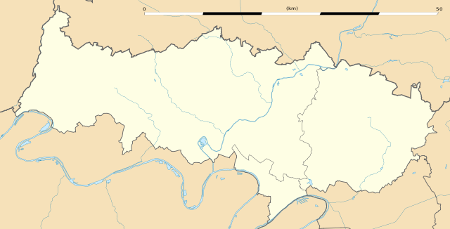
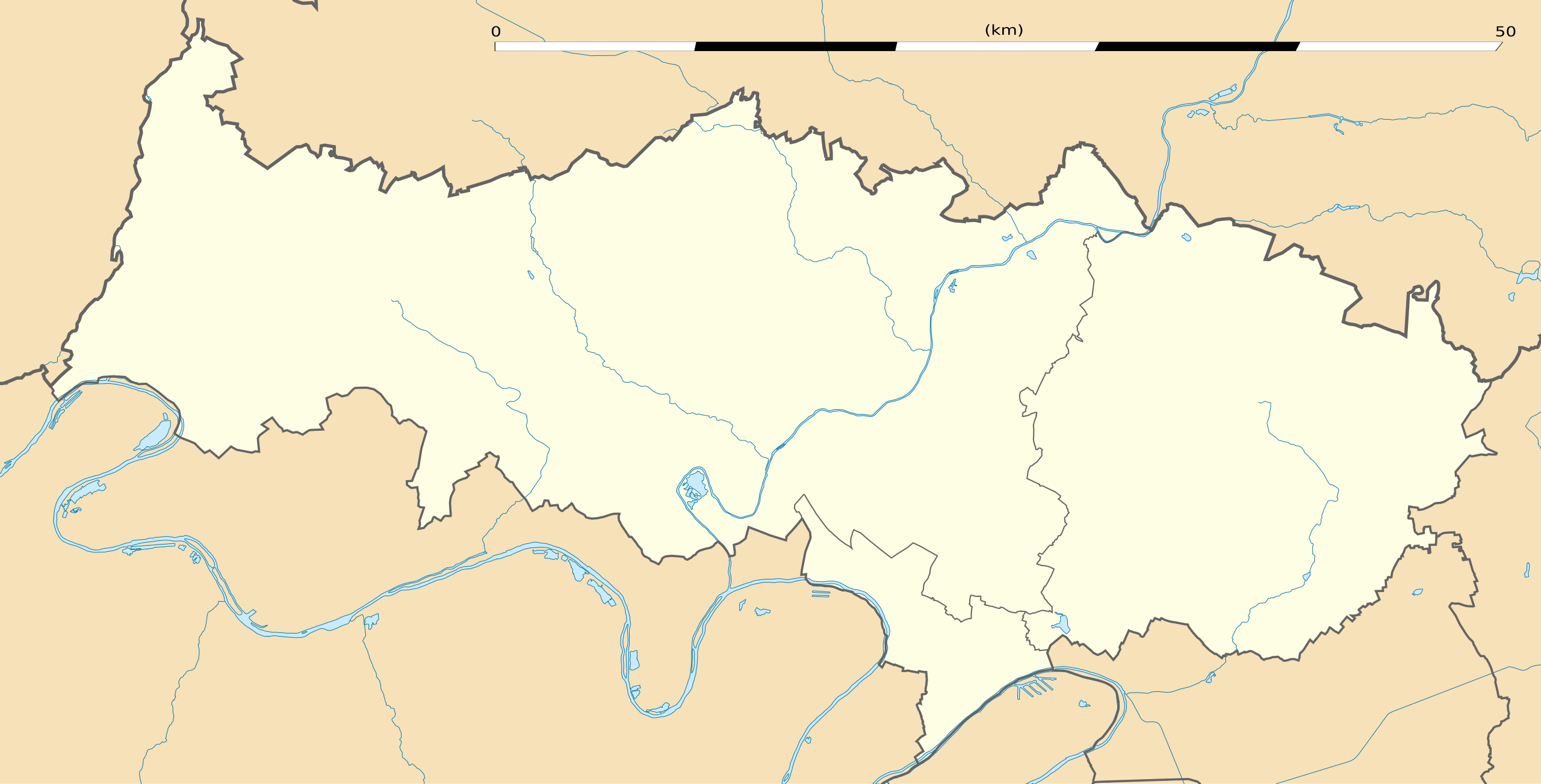
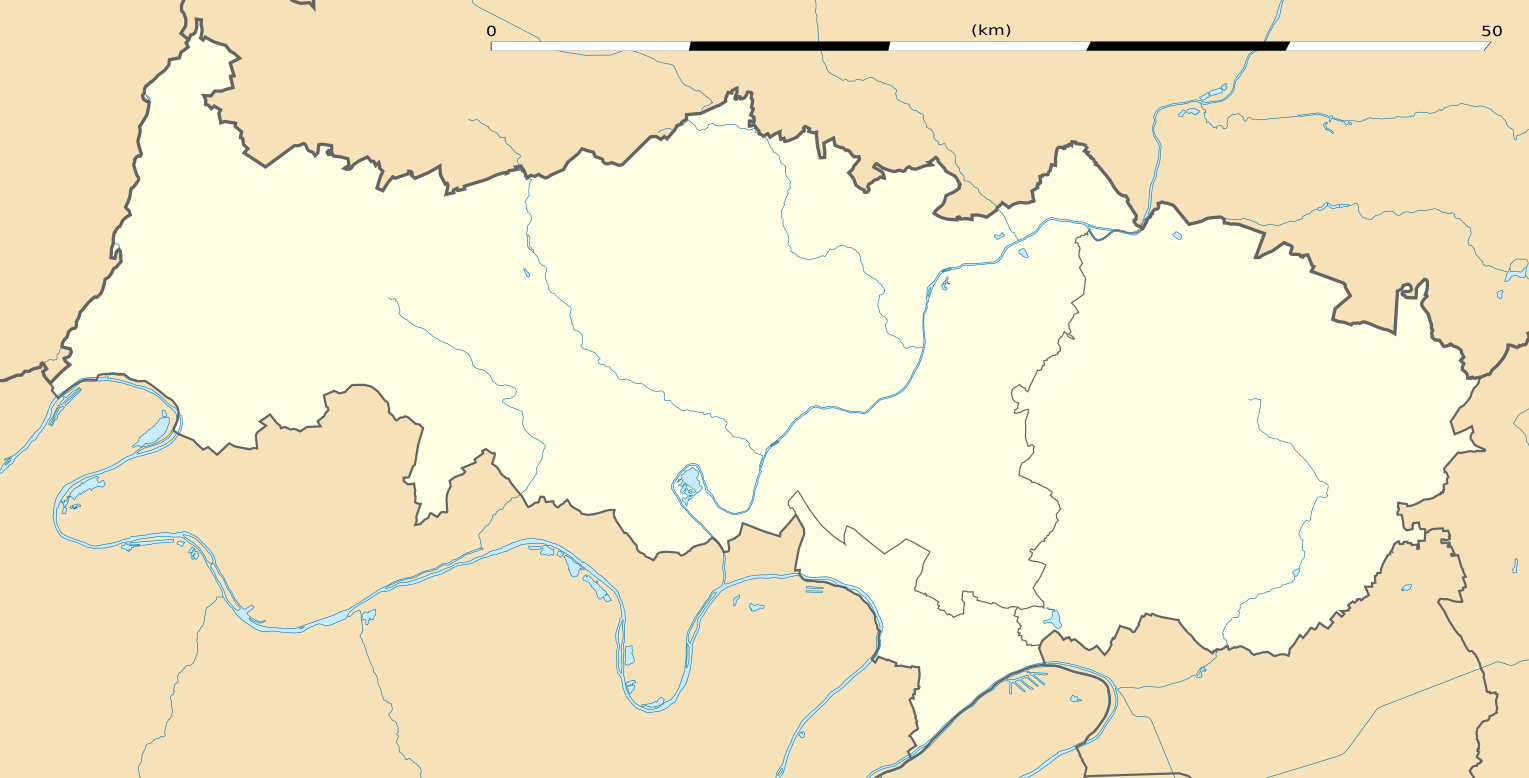
English: Blank administrative map of the department of Val-d'Oise, France, as in January 2015, for geo-location purpose, with distinct boundaries for regions, departments and arrondissements.
Français : Carte administrative vierge du département du Val-d'Oise, France, tel qu'en janvier 2015, destinée à la géolocalisation, avec limite distincte des régions, départements et arrondissements. Estimated scale: 1:200,000 (precision: 50 m)
Geographic limits of the map:
|
||
| Datum | |||
| Quälle |
Eigeni Arbet
|
||
| Urheber | Eric Gaba (Sting - fr:Sting) | ||
| Gnähmigung (Wyternutzig vu däre Datei) |
|
||
| Anderi Versione |
|

Lizänzierig
Eric Gaba, Wikimedia Commons user Sting, dr Urheber vu däm Wärch, vereffetligt s dodermit unter däre Lizänz:
Die Datei isch lizänziert unter dr Creative-Commons-Lizenz Namensnännig – Wytergab unter glyche Bedingige 3.0 nit portiert.
Namenännig: Eric Gaba, Wikimedia Commons user Sting
- Du derfsch:
- des Wärch an anderi wytergee – des Wärch kopiere, verbreite un ibertrage
- des Wärch verändere – des Wärch aapasse
- Unter däne Bedingige:
- Namenännig – Du muesch aagmässeni Aagabe zum Urheber un dr Rächt mache, e Link zue dr Lizänz zuefiege un aagee, eb Änderige gmacht wore sin. Die Aagabe chenne in ere aagmässene Art gmacht wäre, aber nit eso, ass dr Yydruck entstoht, ass dr Lizänzgeber Dii oder Dyy Gebruch vum Wärch unterstitze un guetheiße.
- Wytergab unter glyche Bedingige – Wänn du des Wärch veränderesch, umwandlesch oder druf ufböusch, no derfsch s Ergebnis nume unter dr glyche oder ere kumpatible Lizänz wie s Orginal vereffetlige.
Dateiversione
Klick uf e Zytpunkt zu aazeige, wie s dert usgsäh het.
| Version vom | Vorschaubild | Mäß | Benutzer | Kommentar | |
|---|---|---|---|---|---|
| aktuell | 05:03, 22. Jan. 2015 | | 1.529 × 778 (345 KB) | Sting | == {{int:filedesc}} == {{Location|49|04|30|N|02|06|00|E|scale:300000}} {{Information |Description={{en|Blank administrative map of the department of Val-d'Oise, France, as in January 2015, for geo-location purpose, with distinct boun... |
Verwändig vu dr Datei
Di folgende Sytene händ en Link zu dem Bildli:
Wältwyti Dateinutzig
Die andere Wikis bruche die Datei:
- Gebruch uf de.wikipedia.org
- Gebruch uf eo.wikipedia.org
- Gonesse
- Cormeilles-en-Parisis
- Fontenay-en-Parisis
- Argenteuil
- Bezons
- Taverny
- Franconville
- Eaubonne
- Ermont
- Deuil-la-Barre
- Cergy
- Garges-lès-Gonesse
- Goussainville (Val-d'Oise)
- Auvers-sur-Oise
- Saint-Ouen-l'Aumône
- Pierrelaye
- Fosses
- Louvres
- Le Plessis-Bouchard
- Survilliers
- Groslay
- Ézanville
- Moisselles
- Saint-Leu-la-Forêt
- Sannois
- Chars
- Osny
- Boissy-l'Aillerie
- Santeuil (Val-d'Oise)
- Us (Val-d'Oise)
- Montgeroult
- La Frette-sur-Seine
- Viarmes
- Seugy
- Luzarches
- Bessancourt
- Frépillon
- Méry-sur-Oise
- Mériel
- Champagne-sur-Oise
- Persan (Val-d'Oise)
- Beaumont-sur-Oise
- Maffliers
- Montsoult
- Villaines-sous-Bois
- Butry-sur-Oise
- Parmain
- L'Isle-Adam
Wältwyti Verwändig vu däre Datei aaluege.