
Datei:DEntrecasteauxIslandsTopography.png

Greßi vu däre Vorschau: 670 × 599 Pixel. Wyteri Ufflösige: 268 × 240 Pixel | 537 × 480 Pixel | 859 × 768 Pixel | 1.145 × 1.024 Pixel | 1.924 × 1.721 Pixel.
Originaldatei (1.924 × 1.721 Pixel, Dateigrößi: 1,19 MB, MIME-Typ: image/png)
| Die Datei un d Informatione derzue were us em zäntrale Mediearchiv Wikimedia Commons (Allmänd) iibunde. | Zur Bschriibigssite uff de Allmänd |
Bschryybig
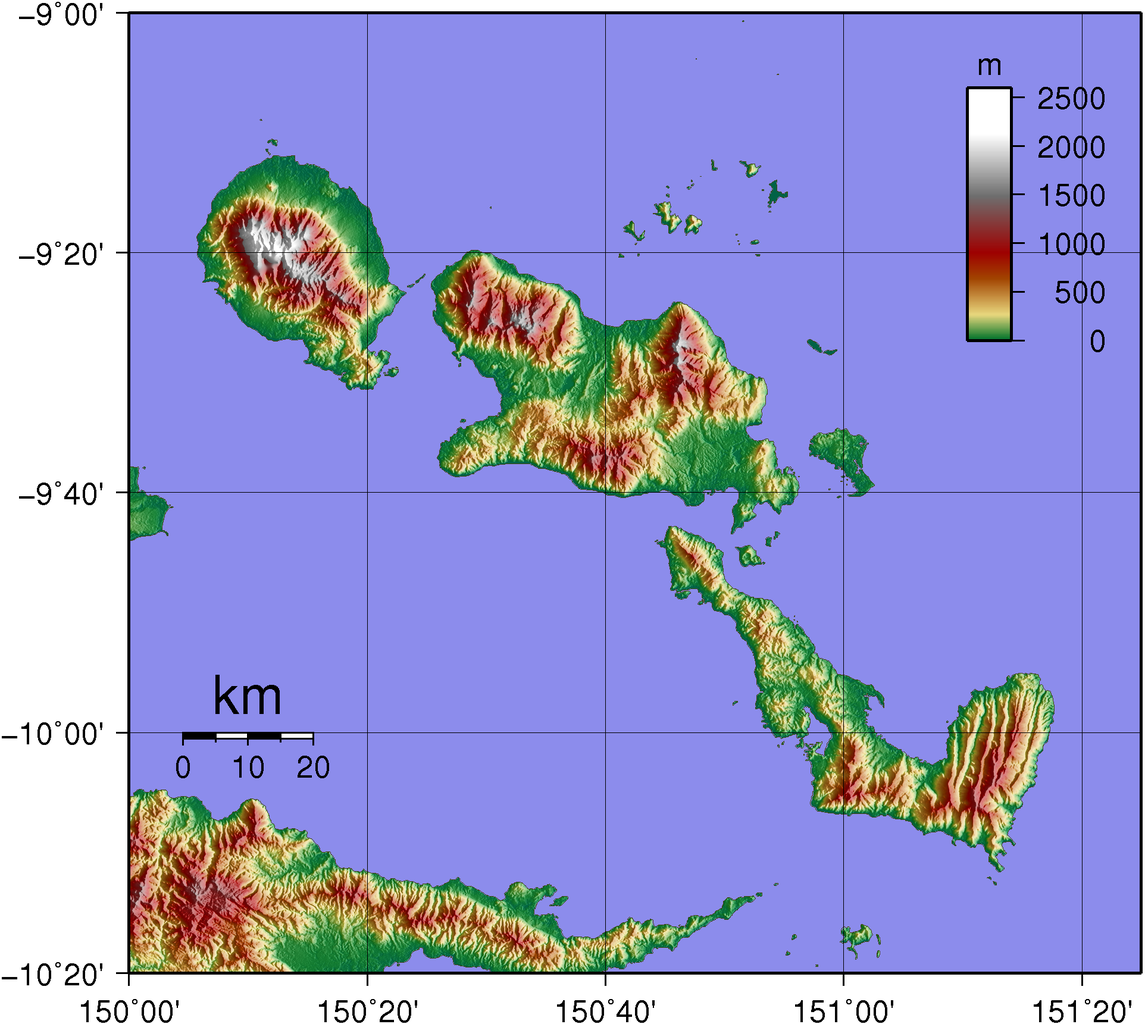
| Bschryybig | Topographic map of D'Entrecasteaux Islands in Papua New Guinea. |
| Datum | |
| Quälle | Created with GMT from publicly available SRTM data |
| Urheber | Sadalmelik |
Lizänzierig
| Ich, dr Urheberrächtsinhaber vu däm Wärch, tue s as gmeinfrej vereffentlige . Des giltet wältwyt. In mänke Staate chennt des rächtli nit megli syy. Wänn des imfall eso isch: Ich gib e jedem s bedingiglos Rächt, des Wärch jedwädere Zwäck z nutze, ußer s git gesetzlig erforderligi Bedingige. |
Dateiversione
Klick uf e Zytpunkt zu aazeige, wie s dert usgsäh het.
| Version vom | Vorschaubild | Mäß | Benutzer | Kommentar | |
|---|---|---|---|---|---|
| aktuell | 22:09, 2. Jun. 2007 | | 1.924 × 1.721 (1,19 MB) | Sadalmelik | {{Information |Description=Topographic map of D'Entrecasteaux Islands in Papua New Guinea. |Source=Created with GMT from publicly available SRTM data |Date=June 2, 2007 |Author= User:Sadalmelik }} |
Verwändig vu dr Datei
Di folgende Sytene händ en Link zu dem Bildli:
Wältwyti Dateinutzig
Die andere Wikis bruche die Datei:
- Gebruch uf de.wikipedia.org
- Gebruch uf en.wikipedia.org
- Gebruch uf it.wikipedia.org
- Gebruch uf ja.wikipedia.org
- Gebruch uf ka.wikipedia.org
- Gebruch uf ko.wikipedia.org
- Gebruch uf lt.wikipedia.org
- Gebruch uf no.wikipedia.org
- Gebruch uf pl.wikipedia.org
- Gebruch uf pnb.wikipedia.org
- Gebruch uf pt.wikipedia.org
- Gebruch uf ru.wikipedia.org