
Datei:Centre-Val de Loire region location map.svg

Gröössi vor PNG-Vorschou vor SVG-Datei: 492 × 600 Pixel. Wyteri Ufflösige: 197 × 240 Pixel | 394 × 480 Pixel | 630 × 768 Pixel | 840 × 1.024 Pixel | 1.680 × 2.048 Pixel | 1.726 × 2.104 Pixel.
Originaldatei (SVG-Datei, Basisgrößi: 1.726 × 2.104 Pixel, Dateigrößi: 4,32 MB)
| Die Datei un d Informatione derzue were us em zäntrale Mediearchiv Wikimedia Commons (Allmänd) iibunde. | Zur Bschriibigssite uff de Allmänd |
united state of America
Bschryybig
| Bschryybig |
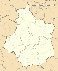
Français : Carte administrative vierge de la région Centre-Val de Loire, France, destinée à la géolocalisation. Projection "Géoportail" (projection équirectangulaire à la latitude de référence 46.5° Nord)
|
| Datum | |
| Quälle |
Eigeni Arbet
|
| Urheber | Flappiefh |
| Anderi Versione |
|
| SVG‑Erstellung |

Lizänzierig
Ich haa s Urheberrächt an däm Wärch un vereffetlig s dodermit unter däre Lizänz:
Diese Datei ist lizenziert unter der Creative-Commons-Lizenz „Namensnennung – Weitergabe unter gleichen Bedingungen 4.0 international“.
- Du derfsch:
- des Wärch an anderi wytergee – des Wärch kopiere, verbreite un ibertrage
- des Wärch verändere – des Wärch aapasse
- Unter däne Bedingige:
- Namenännig – Du muesch aagmässeni Aagabe zum Urheber un dr Rächt mache, e Link zue dr Lizänz zuefiege un aagee, eb Änderige gmacht wore sin. Die Aagabe chenne in ere aagmässene Art gmacht wäre, aber nit eso, ass dr Yydruck entstoht, ass dr Lizänzgeber Dii oder Dyy Gebruch vum Wärch unterstitze un guetheiße.
- Wytergab unter glyche Bedingige – Wänn du des Wärch veränderesch, umwandlesch oder druf ufböusch, no derfsch s Ergebnis nume unter dr glyche oder ere kumpatible Lizänz wie s Orginal vereffetlige.
Dateiversione
Klick uf e Zytpunkt zu aazeige, wie s dert usgsäh het.
| Version vom | Vorschaubild | Mäß | Benutzer | Kommentar | |
|---|---|---|---|---|---|
| aktuell | 18:57, 13. Okt. 2015 | | 1.726 × 2.104 (4,32 MB) | Flappiefh | User created page with UploadWizard |
Verwändig vu dr Datei
Di folgende Sytene händ en Link zu dem Bildli:
Wältwyti Dateinutzig
Die andere Wikis bruche die Datei:
- Gebruch uf azb.wikipedia.org
- Gebruch uf bn.wikipedia.org
- Gebruch uf de.wikipedia.org
- Wikipedia:Kartenwerkstatt/Positionskarten/Europa
- Flughafen Tours
- Flughafen Châteauroux
- Stade de la Vallée du Cher
- Stade Gaston Petit
- Stade Jules-Ladoumègue
- Pont Jacques Gabriel
- ZooParc de Beauval
- Militärflugplatz Châteaudun
- Flugplatz Romorantin-Pruniers
- Vorlage:Positionskarte Frankreich Centre-Val de Loire
- Pont Wilson (Tours)
- Gebruch uf el.wikipedia.org
- Gebruch uf en.wikipedia.org
- Tours
- Chinon
- Chenonceaux
- Orléans
- Bourges
- Blois
- Chartres
- Montrichard
- Malesherbes, Loiret
- Vendôme
- Amboise
- Valençay
- Saint-Brisson-sur-Loire
- Azay-le-Rideau
- Beaulieu-sur-Loire
- La Chapelle-Saint-Sépulcre
- Courtenay, Loiret
- Saint-Aignan-le-Jaillard
- Dreux
- Patay, Loiret
- Châteauroux
- Nohant-Vic
- La Chapelle-d'Angillon
- Sully-sur-Loire
- Vouvray
- Le Grand-Pressigny
- Anet
Wältwyti Verwändig vu däre Datei aaluege.