
Datei:Noord-Holland position.svg

Gröössi vor PNG-Vorschou vor SVG-Datei: 200 × 236 Pixel. Wyteri Ufflösige: 203 × 240 Pixel | 407 × 480 Pixel | 651 × 768 Pixel | 868 × 1.024 Pixel | 1.736 × 2.048 Pixel.
Originaldatei (SVG-Datei, Basisgrößi: 200 × 236 Pixel, Dateigrößi: 158 KB)
| Die Datei un d Informatione derzue were us em zäntrale Mediearchiv Wikimedia Commons (Allmänd) iibunde. | Zur Bschriibigssite uff de Allmänd |
Bschryybig
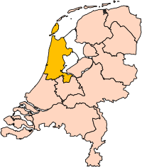
| Bschryybig | Location of the province of Noord-Holland (North Holland) in the Netherlands. |
| Datum | |
| Quälle | Own work, based on freely available GIS data |
| Urheber | User:Mtcv |
| Gnähmigung (Wyternutzig vu däre Datei) |
Data: attribution required; my work: PD |
| Anderi Versione | I attempted to make an svg version of Image:Noord Holland-Position.png (with less simplified boundaries) |
Clickable version

Lizänzierig

|
Dr Urheber vu däre Datei, Centraal Bureau voor de Statistiek, erlaubt, ass e jede si cha bruche fir jede Zwäck, unter dr Voruussetzig ass dr Urheber korräkt gnännt wird. Wyterverbreitig, Abänderig, kommerziälli un alli andre Verwändige sin zuegloo. |
Namenännig:
|
| Annotations | This image is annotated: View the annotations at Commons |


Dateiversione
Klick uf e Zytpunkt zu aazeige, wie s dert usgsäh het.
| Version vom | Vorschaubild | Mäß | Benutzer | Kommentar | |
|---|---|---|---|---|---|
| aktuell | 19:20, 2. Mär. 2019 | | 200 × 236 (158 KB) | Thayts | update |
| 17:13, 2. Okt. 2006 |  | 200 × 236 (158 KB) | Mtcv | {{Information| |Description=Location of the province of Noord-Holland (North Holland) in the Netherlands. |Source=Own work, based on freely available GIS data |Date=2006-10-02 |Author=User:Mtcv |Permission=Data: attribution required; my work: PD |othe |
Verwändig vu dr Datei
Kei Artikel bruucht die Datei.
Wältwyti Dateinutzig
Die andere Wikis bruche die Datei:
- Gebruch uf ar.wikipedia.org
- أمستردام
- شمال-هولندا
- هلفرسوم
- ألكمار
- هارلم (شمال-هولندا)
- زانستاد
- هارلمرمير
- قالب:بلديات شمال هولندا
- سخاخن
- دن هيلدر
- فيلسن
- زانتفورت
- بلوميندال
- ألسمير
- لاندسمير
- أوستزان
- تيسل
- أمستلفين
- إنكهاوزن
- هورن (هولندا)
- فاترلاند
- بيمستر
- بيفيرفايك
- بيرخن (شمال هولندا)
- بلاريكوم
- هيمستيده
- بوابة:أمستردام/قوالب
- بوابة:أمستردام
- حكومة أمستردام
- هارلمرليده آن سبارنفاودا
- آودر- أمستل
- ديمين
- فيسب (هولندا)
- كاستركوم
- دريخترلاند
- إدام- فولندام
- هيمسكيرك
- هيرهوخوفارد
- هيلو (هولندا)
- هولاندز كرون
- هاوزن
- كوخينلاند
- لانجادايك
- لارين (هولندا)
- ميديمبليك
- أوبمير
- بورميراند
- ستيده بروك
- آوتخيست
- آوتهورن
Wältwyti Verwändig vu däre Datei aaluege.