
Datei:Map-Prussia-Hohenzollern.svg

Gröössi vor PNG-Vorschou vor SVG-Datei: 706 × 599 Pixel. Wyteri Ufflösige: 283 × 240 Pixel | 566 × 480 Pixel | 905 × 768 Pixel | 1.207 × 1.024 Pixel | 2.413 × 2.048 Pixel | 2.592 × 2.200 Pixel.
Originaldatei (SVG-Datei, Basisgrößi: 2.592 × 2.200 Pixel, Dateigrößi: 754 KB)
| Die Datei un d Informatione derzue were us em zäntrale Mediearchiv Wikimedia Commons (Allmänd) iibunde. | Zur Bschriibigssite uff de Allmänd |
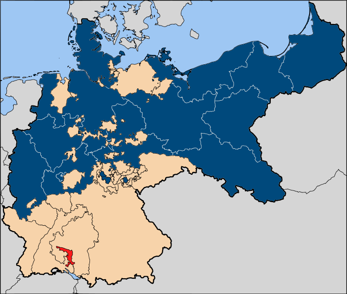
| Bschryybig | The Prussian province of Hohenzollern (red), within the Kingdom of Prussia (blue). |
| Datum | |
| Quälle | Based on map data of the IEG-Maps project (Andreas Kunz, B. Johnen and Joachim Robert Moeschl: University of Mainz) - http://www.ieg-maps.uni-mainz.de |
| Urheber | User:52 Pickup |
| Gnähmigung (Wyternutzig vu däre Datei) |
Die Datei isch lizänziert unter dr Creative-Commons-Lizenz Namensnännig – Wytergab unter glyche Bedingige 2.5 generisch.
|
Dateiversione
Klick uf e Zytpunkt zu aazeige, wie s dert usgsäh het.
| Version vom | Vorschaubild | Mäß | Benutzer | Kommentar | |
|---|---|---|---|---|---|
| aktuell | 19:21, 13. Jan. 2007 | | 2.592 × 2.200 (754 KB) | 52 Pickup | {{Information| |Description=The Prussian {{link|province of Hohenzollern}} (red), within the {{link|Kingdom of Prussia}} (blue). |Source= Based on map data of the IEG-Maps project (Andreas Kunz, B. Johnen and Joachim Robert Moeschl: University of Mainz) |
Verwändig vu dr Datei
Di folgende Sytene händ en Link zu dem Bildli:
Wältwyti Dateinutzig
Die andere Wikis bruche die Datei:
- Gebruch uf de.wikipedia.org
- Gebruch uf en.wikipedia.org
- Gebruch uf fr.wikipedia.org
- Gebruch uf lt.wikipedia.org