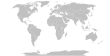
Datei:BlankMap-World-Compact.svg

Seiteninhalte werden in anderen Sprachen nicht unterstützt.
Us der alemannische Wikipedia, der freie Dialäkt-Enzyklopedy

Originaldatei(SVG-Datei, Basisgrößi: 2.560 × 1.134 Pixel, Dateigrößi: 1,01 MB)

Die Datei un d Informatione derzue were us em zäntrale Mediearchiv Wikimedia Commons (Allmänd) iibunde. Zur Bschriibigssite uff de Allmänd Zur Bschriibigssite uff de Allmänd
Diese Weltkarte is saved in human-editable plain text format. Any editing of the image or creation of any derivative work should be performed using a text editor. Please do not upload edits saved or exported with Inkscape or similar vector graphics editors, as well as with automated tools such as SVG Translate.
Warning This Robinson projection map without the earth's elliptical outline is professionally not recommended to be used. See here.
Bschryybig

Detailed SVG map with grouping enabled to connect all non-contiguous parts of a country's territory for easy colouring. Smaller countries can also be represented by larger circles to show their data easier. A thorough description of use and other instructions can be found on the instruction page for the non-compact map.

This is a more compact version of BlankMap-World.svg where Antarctica has been removed. Please make any updates primarily to the other map since this one should be kept as identical to the original as possible.
Datum
Quälle Based on BlankMap-World.svg
Urheber Canuckguy et al.
Gnähmigung
(Wyternutzig vu däre Datei)
Public domain Ich, dr Urheberrächtsinhaber vu däm Wärch, tue s as gmeinfrej vereffentlige . Des giltet wältwyt.
In mänke Staate chennt des rächtli nit megli syy. Wänn des imfall eso isch:
Ich gib e jedem s bedingiglos Rächt, des Wärch jedwädere Zwäck z nutze, ußer s git gesetzlig erforderligi Bedingige.
Anderi Versione
Original version including Antarctica and elliptic outline of the ocean
Abgleiteti Wärk vo dere Datei:
SVG‑Erstellung
InfoField
W3C grn 
Der SVG-Code ist valide.
Inkscape to text 
Diese Vektorgrafik wurde mit Inkscape erstellt und dann manuell nachbearbeitet
.
Annotations
InfoField
This image is annotated: View the annotations at Commons

Kurzbeschreibungen

Ergänze eine einzeilige Erklärung, was diese Datei darstellt.

In dieser Datei abgebildete Objekte

Motiv

MIME-Typ Tüütsch

image/svg+xml

Prüfsumme Tüütsch

632e9b62855a9ab28da328c9ab96213b5862d936

Bestimmungsmethode Tüütsch: SHA-1 Tüütsch

Dateigröße Tüütsch

1.055.892 Byte

1.134 Pixel

Breite Tüütsch

2.560 Pixel

Dateiversione

Klick uf e Zytpunkt zu aazeige, wie s dert usgsäh het.

(Nöischti | Eltischti) (nächschti 10) () aazeige; (10 | 20 | 50 | 100 | 250 | 500) uf ds Mal
Version vomVorschaubildMäßBenutzerKommentar
aktuell14:56, 11. Okt. 2023Vorschaubild fir Version vum 14:56, 11. Okt. 20232.560 × 1.134 (1,01 MB)YodinLatest version is minified, and no longer easily text-editable; Reverted to version as of 14:50, 16 March 2019 (UTC)
19:07, 10. Okt. 2023Vorschaubild fir Version vum 19:07, 10. Okt. 2023512 × 227 (754 KB)Ahmed0arafatfix african countries count to 54
16:50, 16. Mär. 2019Vorschaubild fir Version vum 16:50, 16. Mär. 20192.560 × 1.134 (1,01 MB)GomolokoI corrected Transnistria tag showing in a larger area than it should, instead of Moldova
09:09, 11. Mär. 2019Vorschaubild fir Version vum 09:09, 11. Mär. 20192.560 × 1.134 (1,01 MB)GomolokoI corrected West Bank (State of Palestine) name not showing when the mouse was over the area
02:51, 11. Mär. 2019Vorschaubild fir Version vum 02:51, 11. Mär. 20192.560 × 1.134 (1,01 MB)Gomolokolast change :) Gambia, Republic of The
02:25, 11. Mär. 2019Vorschaubild fir Version vum 02:25, 11. Mär. 20192.560 × 1.134 (1,01 MB)GomolokoI reverted all changes and made only the following according to www.un.org : North Macedonia, United States of America, Eswatini, United Kingdom of Great Britain and Northern Ireland, Cabo Verde
23:02, 10. Mär. 2019Vorschaubild fir Version vum 23:02, 10. Mär. 20192.560 × 1.134 (1,01 MB)GomolokoNorth Macedonia, Republic of _ Congo, Democratic Republic of the _ Kyrgyz Republic _ Vietnam, Socialist Republic of _ China, People's Republic of _ United States of America _ Eswatini, Kingdom of _ Cabo Verde, Republic of
23:55, 10. Feb. 2018Vorschaubild fir Version vum 23:55, 10. Feb. 20182.560 × 1.134 (1,01 MB)FibonacciUpdated the map with land and water outlines from the original.
21:32, 25. Aug. 2012Vorschaubild fir Version vum 21:32, 25. Aug. 2012940 × 415 (1,45 MB)KpengboyReverted to version as of 16:35, 13 February 2012 (there's a reason the code wasn't "optimised". re-add transparency if you think it's better)
22:57, 17. Apr. 2012Vorschaubild fir Version vum 22:57, 17. Apr. 2012940 × 415 (818 KB)Fred the OysterCorrected my faux pas with the upper and lower margins
(Nöischti | Eltischti) (nächschti 10) () aazeige; (10 | 20 | 50 | 100 | 250 | 500) uf ds Mal

Kei Artikel bruucht die Datei.

Wältwyti Dateinutzig

Metadate