
Datei:Saint-Martin collectivity location map.svg

Gröössi vor PNG-Vorschou vor SVG-Datei: 800 × 578 Pixel. Wyteri Ufflösige: 320 × 231 Pixel | 640 × 462 Pixel | 1.024 × 740 Pixel | 1.280 × 925 Pixel | 2.560 × 1.850 Pixel | 1.175 × 849 Pixel.
Originaldatei (SVG-Datei, Basisgrößi: 1.175 × 849 Pixel, Dateigrößi: 182 KB)
| Die Datei un d Informatione derzue were us em zäntrale Mediearchiv Wikimedia Commons (Allmänd) iibunde. | Zur Bschriibigssite uff de Allmänd |
Bschryybig
| Kameraposition | | Dieses und weitere Bilder auf OpenStreetMap |
|---|
| Bschryybig |
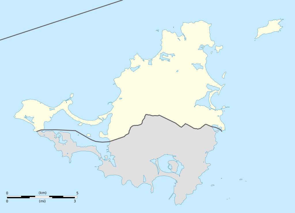
English: Blank administrative map of the overseas collectivity of Saint Martin, France, for geo-location purpose.
Français : Carte administrative vierge de la collectivité d'outre-mer de Saint-Martin, France, destinée à la géolocalisation. Estimated scale: 1:200,000 (precision: 50 m)
Geographic limits of the map:
|
||
| Datum | |||
| Quälle |
Eigeni Arbet
|
||
| Urheber | Eric Gaba (Sting - fr:Sting) | ||
| Gnähmigung (Wyternutzig vu däre Datei) |
|
||
| Anderi Versione |
|


Lizänzierig
Ich haa s Urheberrächt an däm Wärch un vereffetlig s dodermit unter däne Lizänze:
Die Datei isch lizänziert unter dr Creative-Commons-Lizenz Namensnännig – Wytergab unter glyche Bedingige 3.0 nit portiert.
- Du derfsch:
- des Wärch an anderi wytergee – des Wärch kopiere, verbreite un ibertrage
- des Wärch verändere – des Wärch aapasse
- Unter däne Bedingige:
- Namenännig – Du muesch aagmässeni Aagabe zum Urheber un dr Rächt mache, e Link zue dr Lizänz zuefiege un aagee, eb Änderige gmacht wore sin. Die Aagabe chenne in ere aagmässene Art gmacht wäre, aber nit eso, ass dr Yydruck entstoht, ass dr Lizänzgeber Dii oder Dyy Gebruch vum Wärch unterstitze un guetheiße.
- Wytergab unter glyche Bedingige – Wänn du des Wärch veränderesch, umwandlesch oder druf ufböusch, no derfsch s Ergebnis nume unter dr glyche oder ere kumpatible Lizänz wie s Orginal vereffetlige.

|
Des Dokumänt derf kopiert, verbreitet un/oder bearbeitet wäre unter dr Bedingige vu dr GNU-Lizänz fir freji Dokumäntation, Version 1.2 oder ere spetere Version, vereffetligt dur Free Software Foundation. S het keini uuveränderlige Abschnitt, kei vordere Umschlagstext un kei hindere Umschlagstext. E Kopii vu dr Lizänz isch verfiegbar im Abschnitt GNU-Lizänz fir freji Dokumäntation. |
Du chasch sälber e Lizänz uuswehle.
Dateiversione
Klick uf e Zytpunkt zu aazeige, wie s dert usgsäh het.
| Version vom | Vorschaubild | Mäß | Benutzer | Kommentar | |
|---|---|---|---|---|---|
| aktuell | 21:42, 17. Jan. 2009 | | 1.175 × 849 (182 KB) | Sting | == Summary == {{Location|18|04|07|N|63|03|45|W|scale:100000}} <br/> {{Information |Description={{en|Blank administrative map of the overseas collectivity of Saint Martin, France, f |
Verwändig vu dr Datei
Di folgende Sytene händ en Link zu dem Bildli:
Wältwyti Dateinutzig
Die andere Wikis bruche die Datei:
- Gebruch uf af.wikipedia.org
- Gebruch uf an.wikipedia.org
- Gebruch uf ar.wikipedia.org
- Gebruch uf ast.wikipedia.org
- Gebruch uf be-tarask.wikipedia.org
- Gebruch uf bg.wikipedia.org
- Gebruch uf bn.wikipedia.org
- Gebruch uf bs.wikipedia.org
- Gebruch uf ceb.wikipedia.org
- Plantilya:Location map Saint-Martin
- Green Cay
- Eastern Point
- Red Hill
- Bell Point
- Flagstaff
- Saint-Martin (pagklaro)
- Île Frégate
- Red Rock
- Hope Hill
- Bell Hill
- Pointe Noire
- Marigot
- Le Paradis
- Baie Rouge
- Crocus Hill
- Île Charlotte
- Lac Simpson
- Lac Simson
- Montagne Ronde
- Pointe Bluff
- Pointe Nord
- Saint Martin (pagklaro)
- La Selle
- Mont Fortune
- Baie du Marigot
- Grand Îlet
- Morne Rond
- Le Selle
- Simson Baai Lagoen
- Sint Maarten (pagklaro)
- Pointe Falaise
- Pointe du Bluff
- Spaniard Rock
- Baie Blanche
- Concordia Hill
- Mont des Accords
- Mount Rouge
Wältwyti Verwändig vu däre Datei aaluege.