
Datei:NewBritainTopography.png

Greßi vu däre Vorschau: 800 × 546 Pixel. Wyteri Ufflösige: 320 × 218 Pixel | 640 × 437 Pixel | 1.024 × 698 Pixel | 1.280 × 873 Pixel | 2.208 × 1.506 Pixel.
Originaldatei (2.208 × 1.506 Pixel, Dateigrößi: 1,31 MB, MIME-Typ: image/png)
| Die Datei un d Informatione derzue were us em zäntrale Mediearchiv Wikimedia Commons (Allmänd) iibunde. | Zur Bschriibigssite uff de Allmänd |
Bschryybig
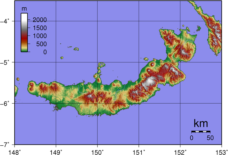
| Bschryybig | Topography of New Britain (island in Papua New Guinea) |
| Datum | |
| Quälle | created with GMT from publicly released SRTM data |
| Urheber | Sadalmelik |
Lizänzierig
| Ich, dr Urheberrächtsinhaber vu däm Wärch, tue s as gmeinfrej vereffentlige . Des giltet wältwyt. In mänke Staate chennt des rächtli nit megli syy. Wänn des imfall eso isch: Ich gib e jedem s bedingiglos Rächt, des Wärch jedwädere Zwäck z nutze, ußer s git gesetzlig erforderligi Bedingige. |
Dateiversione
Klick uf e Zytpunkt zu aazeige, wie s dert usgsäh het.
| Version vom | Vorschaubild | Mäß | Benutzer | Kommentar | |
|---|---|---|---|---|---|
| aktuell | 14:33, 2. Jun. 2007 | | 2.208 × 1.506 (1,31 MB) | Sadalmelik | |
| 21:43, 31. Mai 2007 |  | 2.208 × 1.506 (1,31 MB) | Sadalmelik | {{Information |Description=Topography of New Britain (island in Papua New Guinea) |Source=created with GMT from publicly released SRTM data |Date=May 31st, 2007 |Author= User:Sadalmelik }} Category:Topography Category:Papua New Guinea |
Verwändig vu dr Datei
Di folgende Sytene händ en Link zu dem Bildli:
Wältwyti Dateinutzig
Die andere Wikis bruche die Datei:
- Gebruch uf af.wikipedia.org
- Gebruch uf ar.wikipedia.org
- Gebruch uf br.wikipedia.org
- Gebruch uf bs.wikipedia.org
- Gebruch uf ca.wikipedia.org
- Gebruch uf de.wikipedia.org
- Gebruch uf de.wikivoyage.org
- Gebruch uf diq.wikipedia.org
- Gebruch uf el.wikipedia.org
- Gebruch uf en.wikipedia.org
- Gebruch uf en.wikiversity.org
- Gebruch uf en.wikivoyage.org
- Gebruch uf eo.wikipedia.org
- Gebruch uf es.wikipedia.org
- Gebruch uf et.wikipedia.org
- Gebruch uf fa.wikipedia.org
- Gebruch uf fi.wikipedia.org
- Gebruch uf fr.wikipedia.org
- Gebruch uf he.wikipedia.org
- Gebruch uf hu.wikipedia.org
- Gebruch uf it.wikipedia.org
- Gebruch uf ka.wikipedia.org
- Gebruch uf kk.wikipedia.org
- Gebruch uf ko.wikipedia.org
- Gebruch uf la.wikipedia.org
- Gebruch uf nl.wikipedia.org
- Gebruch uf nn.wikipedia.org
- Gebruch uf no.wikipedia.org
- Gebruch uf pl.wikipedia.org
- Gebruch uf ro.wikipedia.org
- Gebruch uf sk.wikipedia.org
- Gebruch uf sr.wikipedia.org
- Gebruch uf sv.wikipedia.org
- Gebruch uf ta.wikipedia.org
- Gebruch uf uk.wikipedia.org
- Gebruch uf vi.wikipedia.org
- Gebruch uf www.wikidata.org