
Datei:Map-society-islands-hogg-1784.jpg

Greßi vu däre Vorschau: 800 × 501 Pixel. Wyteri Ufflösige: 320 × 200 Pixel | 640 × 401 Pixel | 1.024 × 642 Pixel | 1.280 × 802 Pixel | 2.560 × 1.604 Pixel | 4.238 × 2.655 Pixel.
Originaldatei (4.238 × 2.655 Pixel, Dateigrößi: 9,57 MB, MIME-Typ: image/jpeg)
| Die Datei un d Informatione derzue were us em zäntrale Mediearchiv Wikimedia Commons (Allmänd) iibunde. | Zur Bschriibigssite uff de Allmänd |
Bschryybig
| Bschryybig |
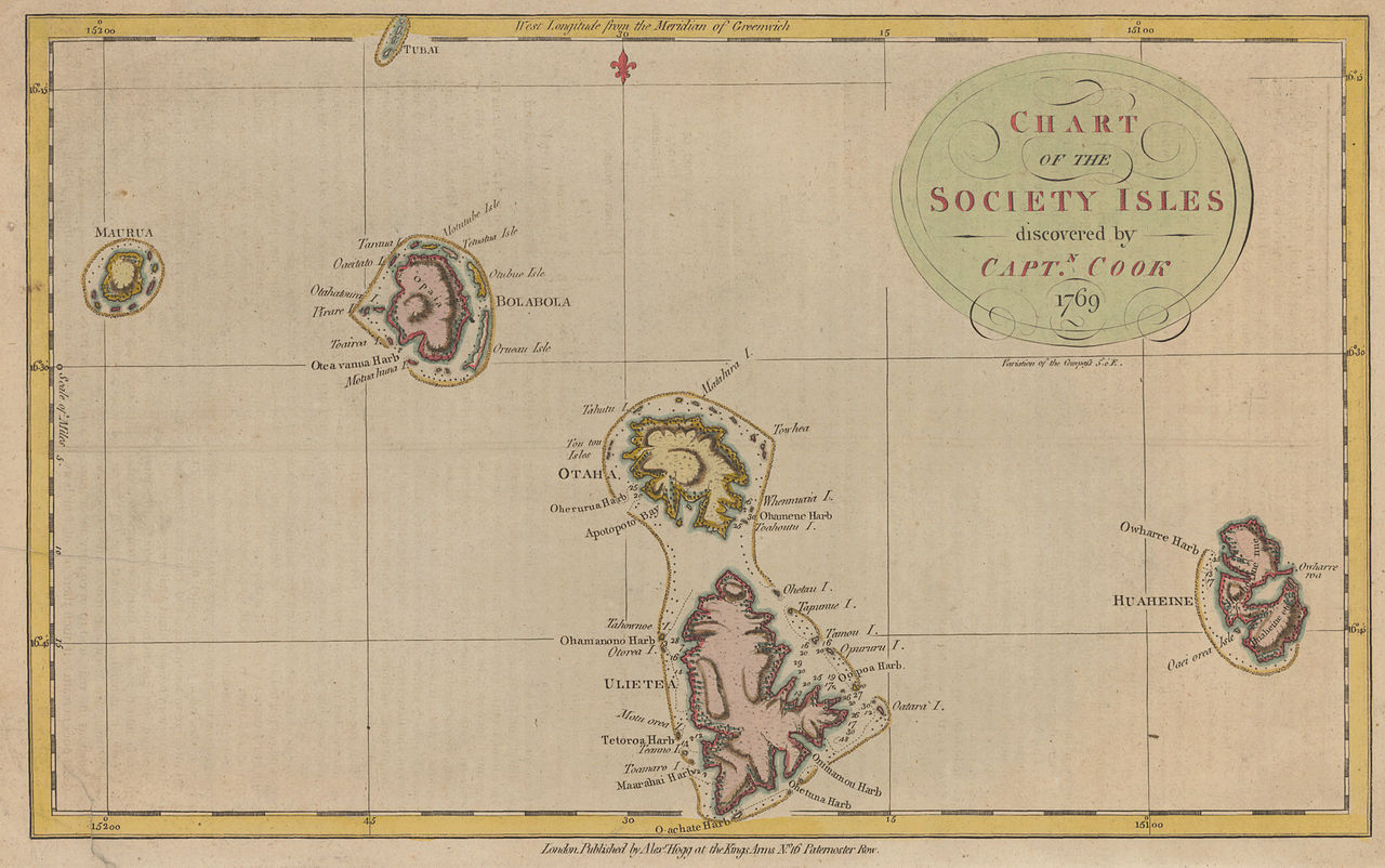
English: historic map of the western Society Islands (Leeward Islands = Îles sous le Vent), French Polynesia, Eastern Pacific Ocean, after James Cook's first voyage |
| Datum | |
| Quälle | http://libweb5.princeton.edu/visual_materials/maps/websites/pacific/cook1/cook1.html |
| Urheber | Alexander Hogg |
| Anderi Versione |
|

.jpg)

Lizänzierig
|
Dieses Werk ist gemeinfrei, weil seine urheberrechtliche Schutzfrist abgelaufen ist. | |
| Vu däre Datei isch feschtgstellt wore, ass si gar kei Yyschränkige vum Urheberrächt, mitsamt verbundener un benochberte Rächt ufwyyst. | |
Dateiversione
Klick uf e Zytpunkt zu aazeige, wie s dert usgsäh het.
| Version vom | Vorschaubild | Mäß | Benutzer | Kommentar | |
|---|---|---|---|---|---|
| aktuell | 15:47, 24. Sep. 2010 | | 4.238 × 2.655 (9,57 MB) | Ratzer | {{Information |Description={{en|1=historic map of the western Society Islands (Leeward Islands = Îles sous le Vent), French Polynesia, Eastern Pacific Ocean, after James Cook's first voyage}} |Source=http://libweb5.princeton.edu/visual_materials/maps/web |
Verwändig vu dr Datei
Di folgende Sytene händ en Link zu dem Bildli:
Wältwyti Dateinutzig
Die andere Wikis bruche die Datei:
- Gebruch uf de.wikipedia.org
- Gebruch uf frr.wikipedia.org