
Datei:New Ireland Topography.png

Greßi vu däre Vorschau: 800 × 580 Pixel. Wyteri Ufflösige: 320 × 232 Pixel | 640 × 464 Pixel | 1.024 × 742 Pixel | 1.280 × 928 Pixel | 2.672 × 1.937 Pixel.
Originaldatei (2.672 × 1.937 Pixel, Dateigrößi: 1,17 MB, MIME-Typ: image/png)
| Die Datei un d Informatione derzue were us em zäntrale Mediearchiv Wikimedia Commons (Allmänd) iibunde. | Zur Bschriibigssite uff de Allmänd |
Bschryybig
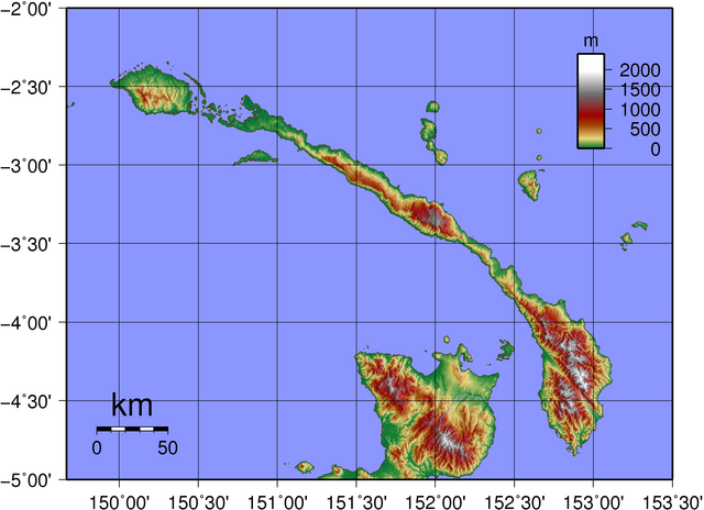
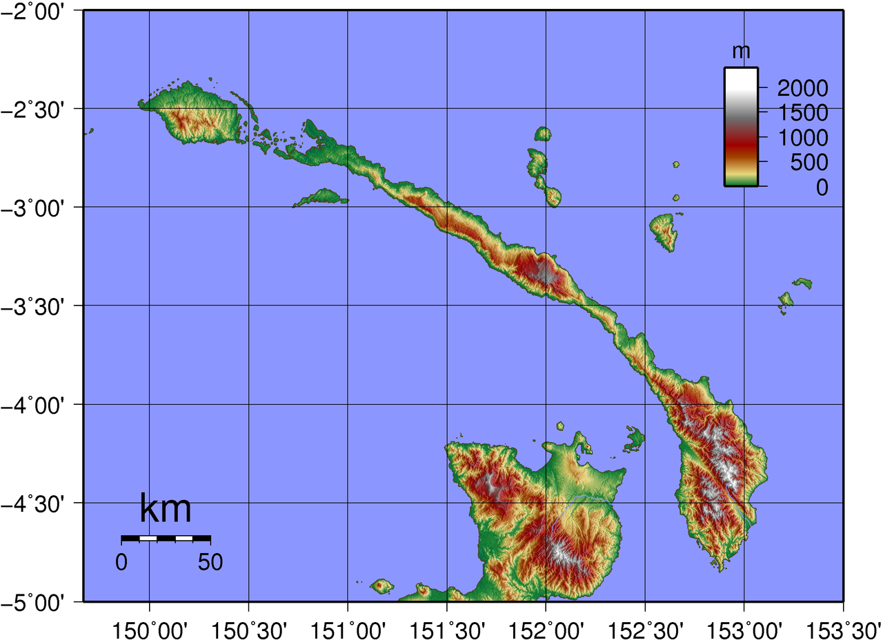
| Bschryybig | Topographic map of New Ireland in Papua New Guinea. Created with GMT from publicly released SRTM data. |
| Datum | |
| Quälle | Eigeni Arbet |
| Urheber | Sadalmelik |
Lizänzierig
| Ich, dr Urheberrächtsinhaber vu däm Wärch, tue s as gmeinfrej vereffentlige . Des giltet wältwyt. In mänke Staate chennt des rächtli nit megli syy. Wänn des imfall eso isch: Ich gib e jedem s bedingiglos Rächt, des Wärch jedwädere Zwäck z nutze, ußer s git gesetzlig erforderligi Bedingige. |
Dateiversione
Klick uf e Zytpunkt zu aazeige, wie s dert usgsäh het.
| Version vom | Vorschaubild | Mäß | Benutzer | Kommentar | |
|---|---|---|---|---|---|
| aktuell | 00:29, 6. Jun. 2007 | | 2.672 × 1.937 (1,17 MB) | Sadalmelik | {{Information |Description=Topographic map of New Ireland in Papua New Guinea. Created with GMT from publicly released SRTM data. |Source=self-made |Date=June 6, 2007 |Author= User:Sadalmelik }} Category:Maps of Papua New Guinea [[Category:Topog |
Verwändig vu dr Datei
Di folgende Sytene händ en Link zu dem Bildli:
Wältwyti Dateinutzig
Die andere Wikis bruche die Datei:
- Gebruch uf af.wikipedia.org
- Gebruch uf be.wikipedia.org
- Gebruch uf bg.wikipedia.org
- Gebruch uf de.wikipedia.org
- Gebruch uf de.wikivoyage.org
- Gebruch uf el.wikipedia.org
- Gebruch uf en.wikipedia.org
- Gebruch uf eo.wikipedia.org
- Gebruch uf et.wikipedia.org
- Gebruch uf fr.wikipedia.org
- Gebruch uf gl.wikipedia.org
- Gebruch uf he.wikipedia.org
- Gebruch uf it.wikipedia.org
- Gebruch uf ko.wikipedia.org
- Gebruch uf la.wikipedia.org
- Gebruch uf lt.wikipedia.org
- Gebruch uf nl.wikipedia.org
- Gebruch uf no.wikipedia.org
- Gebruch uf pl.wikipedia.org
- Gebruch uf pt.wikipedia.org
- Gebruch uf sk.wikipedia.org
- Gebruch uf sv.wikipedia.org
- Gebruch uf ta.wikipedia.org
- Gebruch uf uk.wikipedia.org
- Gebruch uf vi.wikipedia.org
- Gebruch uf www.wikidata.org
- Gebruch uf zh.wikipedia.org