
Datei:Karte Kanton Solothurn Bezirke 2010.png
Greßi vu däre Vorschau: 652 × 599 Pixel. Wyteri Ufflösige: 261 × 240 Pixel | 522 × 480 Pixel | 836 × 768 Pixel | 1.114 × 1.024 Pixel | 2.066 × 1.899 Pixel.
Originaldatei (2.066 × 1.899 Pixel, Dateigrößi: 909 KB, MIME-Typ: image/png)
| Die Datei un d Informatione derzue were us em zäntrale Mediearchiv Wikimedia Commons (Allmänd) iibunde. | Zur Bschriibigssite uff de Allmänd |
| Bschryybig |
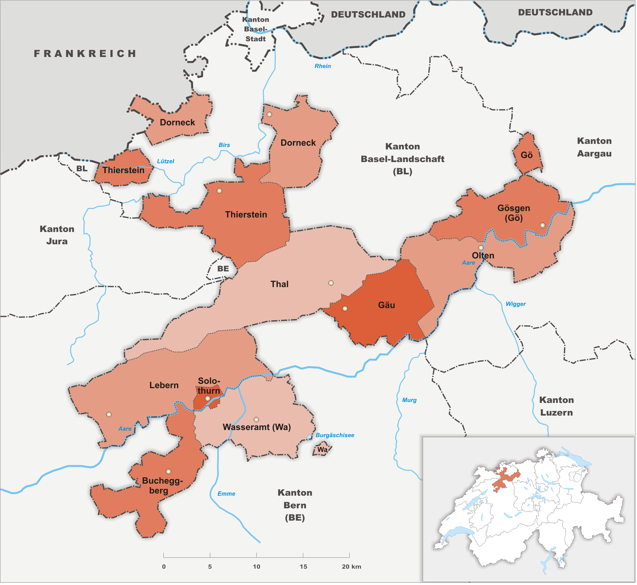
Deutsch: Bezirke des Kanton Solothurn |
||||||||
| Datum | |||||||||
| Quälle | Eigeni Arbet | ||||||||
| Urheber | Tschubby | ||||||||
| Gnähmigung (Wyternutzig vu däre Datei) |
Ich haa s Urheberrächt an däm Wärch un vereffetlig s dodermit unter däne Lizänze:
Die Datei isch lizänziert unter dr Creative-Commons-Lizänze Namensnännig – Wytergab unter glyche Bedingige 2.5 generisch, 2.0 generisch un 1.0 generisch.
Du chasch sälber e Lizänz uuswehle. |

Dateiversione
Klick uf e Zytpunkt zu aazeige, wie s dert usgsäh het.
| Version vom | Vorschaubild | Mäß | Benutzer | Kommentar | |
|---|---|---|---|---|---|
| aktuell | 20:53, 29. Okt. 2009 | | 2.066 × 1.899 (909 KB) | Tschubby | {{Information |Description= {{de|Bezirke des Kanton Solothurn}} |Source={{own}} |Date= 29.10.2009 |Author= Tschubby |Permission= {{self|GFDL|Cc-by-sa-3.0-migrated|Cc-by-sa-2.5,2.0,1.0}} }} [[Category:Maps of |
Verwändig vu dr Datei
Di folgende Sytene händ en Link zu dem Bildli:
Wältwyti Dateinutzig
Die andere Wikis bruche die Datei:
- Gebruch uf cs.wikipedia.org
- Gebruch uf de.wikipedia.org
- Gebruch uf en.wikipedia.org
- Gebruch uf eo.wikipedia.org
- Gebruch uf fi.wikipedia.org
- Gebruch uf fr.wikipedia.org
- Gebruch uf hu.wikipedia.org
- Gebruch uf hy.wikipedia.org
- Gebruch uf id.wikipedia.org
- Gebruch uf it.wikipedia.org
- Gebruch uf sr.wikipedia.org
- Gebruch uf sv.wikipedia.org
- Gebruch uf vi.wikipedia.org