
Datei:Karte Koenigreich Burgund 2 DE.png
Greßi vu däre Vorschau: 588 × 599 Pixel. Wyteri Ufflösige: 235 × 240 Pixel | 471 × 480 Pixel | 753 × 768 Pixel | 1.005 × 1.024 Pixel | 1.500 × 1.529 Pixel.
Originaldatei (1.500 × 1.529 Pixel, Dateigrößi: 202 KB, MIME-Typ: image/png)
| Die Datei un d Informatione derzue were us em zäntrale Mediearchiv Wikimedia Commons (Allmänd) iibunde. | Zur Bschriibigssite uff de Allmänd |
Bschryybig
| Bschryybig |
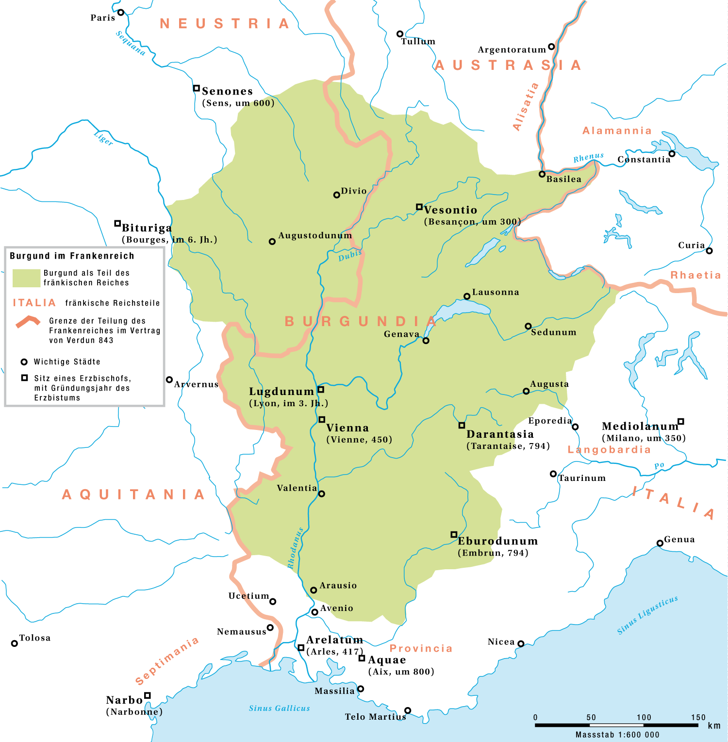
English: Burgundy as a part of the Frankish Empire until the division by the Treaty of Verdun, 843
Deutsch: Burgund als Teil des fränkischen Reichs bis zur Reichsteilung im Vertrag von Verdun 843 |
| Datum | |
| Quälle | Eigeni Arbet |
| Urheber | Marco Zanoli, Sidonius |
| Anderi Versione |
|


Lizänzierig
You may use my work outside wikipedia for free as long as you name me as the author. If you would like to use my work in a print medium, please send me a specimen copy.
Contact me if you have questions regarding the license or if you want individual changes to the map (marco.zanoli at hotmail.ch). Diese Datei ist lizenziert unter der Creative-Commons-Lizenz „Namensnennung – Weitergabe unter gleichen Bedingungen 4.0 international“. Namenännig: Marco Zanoli
|
Dateiversione
Klick uf e Zytpunkt zu aazeige, wie s dert usgsäh het.
| Version vom | Vorschaubild | Mäß | Benutzer | Kommentar | |
|---|---|---|---|---|---|
| aktuell | 06:54, 4. Jul. 2010 | | 1.500 × 1.529 (202 KB) | DcoetzeeBot | Remove watermark, add author and license data to image metadata, decrease filesize with pngcrush |
| 10:49, 29. Aug. 2008 |  | 1.500 × 1.529 (332 KB) | Sidonius | {{Information |Description={{en|1=Burgundy as a part of the Frankish Empire until the division by the Treaty of Verdun, 843}} {{de|1=Burgund als Teil des fränkischen Reichs bis zur Reichsteilung im Vertrag von Verdun 843}} |Source=Eigenes Werk (own work) |
Verwändig vu dr Datei
Di folgende Sytene händ en Link zu dem Bildli:
Wältwyti Dateinutzig
Die andere Wikis bruche die Datei:
- Gebruch uf bg.wikipedia.org
- Gebruch uf de.wikipedia.org
- Gebruch uf fr.wikipedia.org
- Gebruch uf it.wikipedia.org
- Gebruch uf vls.wikipedia.org