
Datei:Bouvet Map.png
Greßi vu däre Vorschau: 787 × 600 Pixel. Wyteri Ufflösige: 315 × 240 Pixel | 630 × 480 Pixel | 1.008 × 768 Pixel | 1.280 × 975 Pixel | 2.560 × 1.950 Pixel | 2.804 × 2.136 Pixel.
Originaldatei (2.804 × 2.136 Pixel, Dateigrößi: 876 KB, MIME-Typ: image/png)
| Die Datei un d Informatione derzue were us em zäntrale Mediearchiv Wikimedia Commons (Allmänd) iibunde. | Zur Bschriibigssite uff de Allmänd |
| Bschryybig |
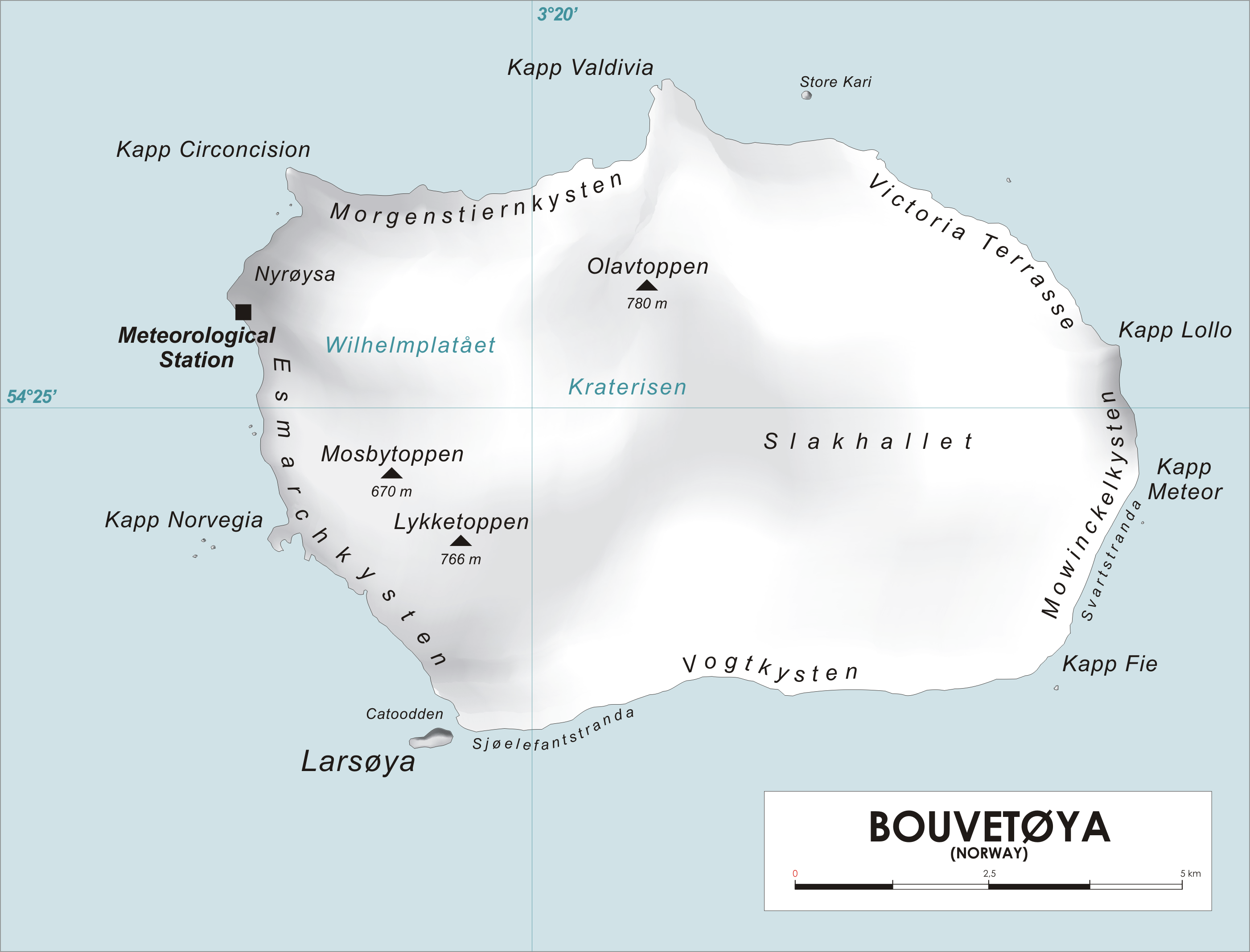
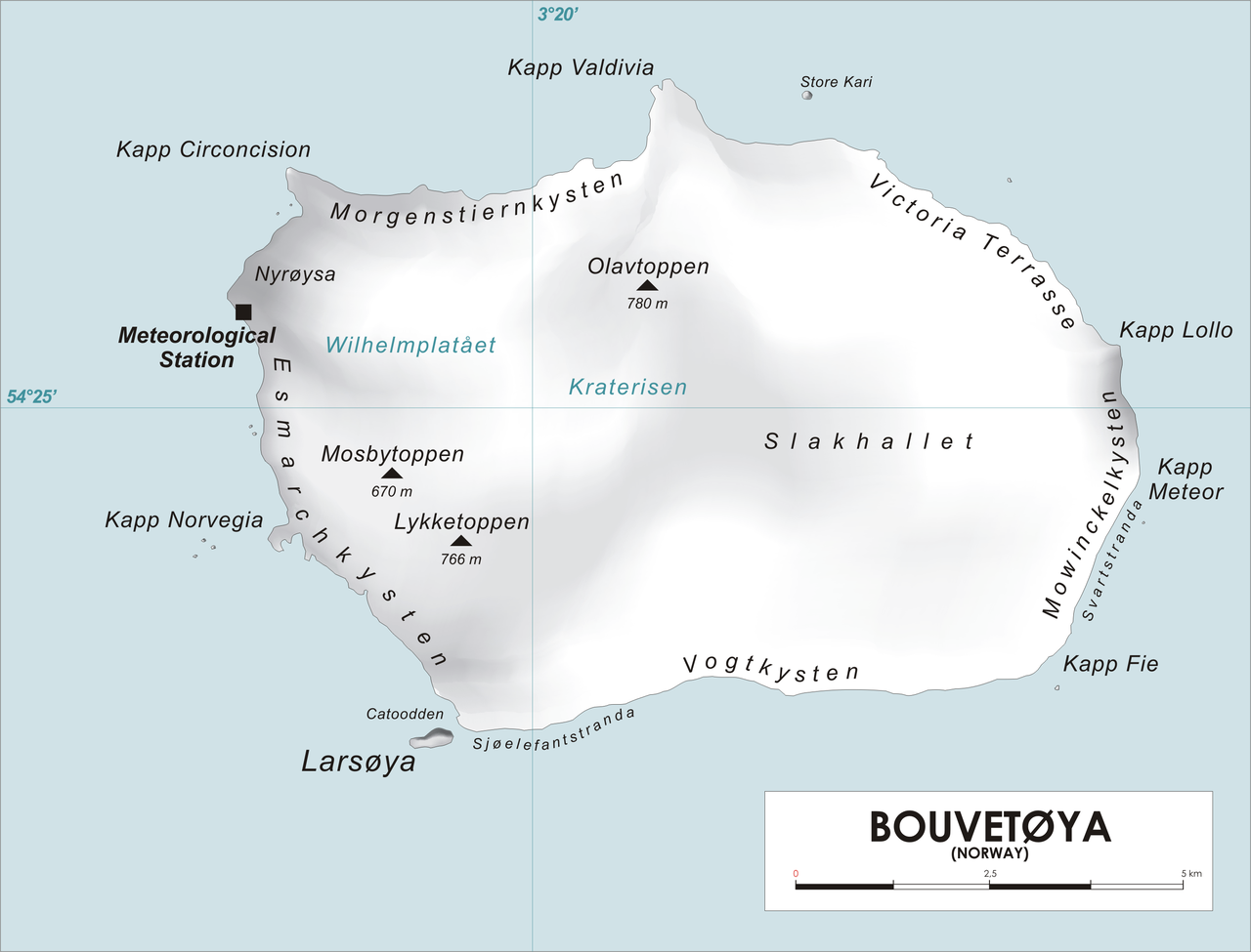
English: Map of Bouvet Island, Southern Atlantic Ocean Norsk bokmål: Kart over Bouvetøya, Sør-Atlanten |
| Quälle | Eigeni Arbet |
| Urheber | varp |
| Ich, dr Urheberrächtsinhaber vu däm Wärch, tue s as gmeinfrej vereffentlige . Des giltet wältwyt. In mänke Staate chennt des rächtli nit megli syy. Wänn des imfall eso isch: Ich gib e jedem s bedingiglos Rächt, des Wärch jedwädere Zwäck z nutze, ußer s git gesetzlig erforderligi Bedingige. |
Dateiversione
Klick uf e Zytpunkt zu aazeige, wie s dert usgsäh het.
| Version vom | Vorschaubild | Mäß | Benutzer | Kommentar | |
|---|---|---|---|---|---|
| aktuell | 14:25, 28. Apr. 2006 | | 2.804 × 2.136 (876 KB) | Varp~commonswiki | *Map of Bouvet Island, Southern Atlantic Ocean *drawn by varp |
Verwändig vu dr Datei
Di folgende Sytene händ en Link zu dem Bildli:
Wältwyti Dateinutzig
Die andere Wikis bruche die Datei:
- Gebruch uf ar.wikipedia.org
- Gebruch uf arz.wikipedia.org
- Gebruch uf ba.wikipedia.org
- Gebruch uf ca.wikipedia.org
- Gebruch uf ceb.wikipedia.org
- Gebruch uf cs.wikipedia.org
- Gebruch uf cy.wikipedia.org
- Gebruch uf da.wikipedia.org
- Gebruch uf de.wikipedia.org
- Gebruch uf de.wikivoyage.org
- Gebruch uf el.wikipedia.org
- Gebruch uf en.wikipedia.org
Wältwyti Verwändig vu däre Datei aaluege.